It’s been a long time since I last posted but California has
been such an adventure I have had little time to work on writing my blog, added to the
fact that it’s not often that I have an internet connection strong enough to
upload the photos etc. So, at long last,
here it is – my first blogpost from California.
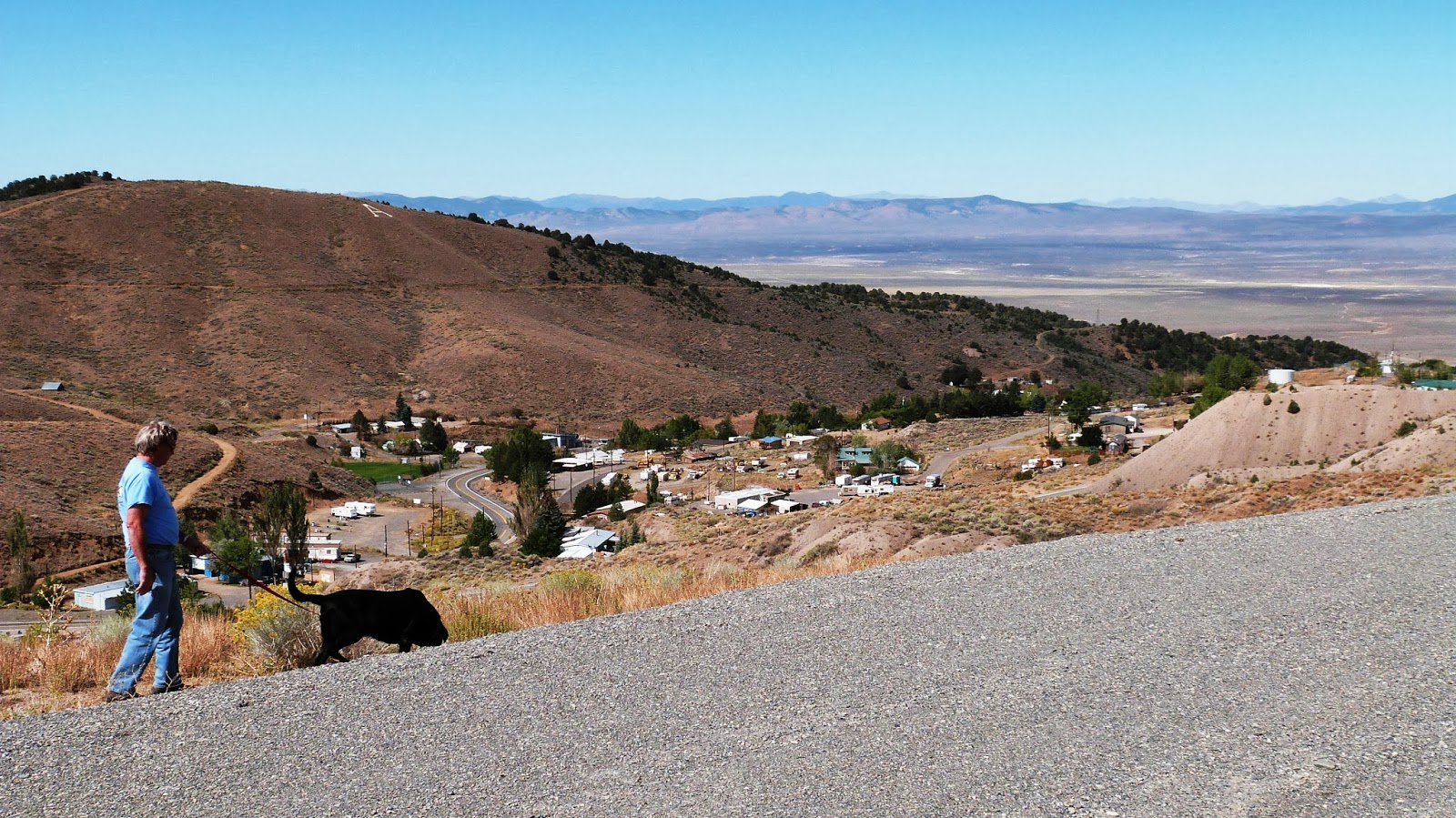
We passed through Reno, Nevada on September 11th
and rode north on route 395 which ran along a range of barren mountains – still
very “desert-like” until we turned west and entered California and magically,
the “hills were alive” with beautiful
conifers. We think most were Douglas
firs and they were absolutely spectacular.
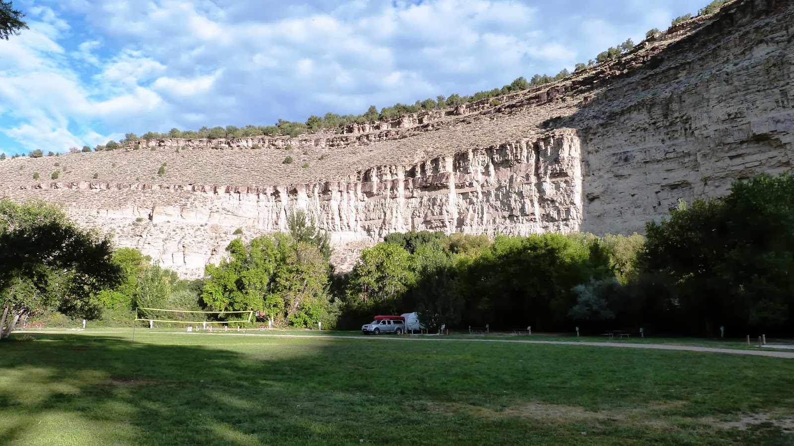
The campground we had picked was Rocky Point campground on Lake Almanor,
a large lake in northeastern California.
The campground itself was wooded everywhere with lots of space between
campsites. We were driving around
looking for a good site when a campground host came up in a golf cart and,
seeing our canoe, told us of an available site that was right on the lake. We gratefully took it and were thrilled that
our back window (we call it the picture window) looked right out on the
lake. The scenery was spectacular and
the sun rose over the lake.


We have found that, generally speaking, the private
campgrounds tend to have more amenities (hook-ups, wifi, laundry, etc) but the
sites are usually close together and often have no shade, whereas the public
campgrounds (federal, state, county) tend to be very scenic with rustic
spacious campsites but very few amenities.
Oh, and the public ones tend to be cheaper; though we have found, like
everything else in California, even the public campgrounds are expensive. And there are always exceptions...
Rocky Point had no hookups, no showers and vault
toilets. It’s not that hard to do
without electricity and we do have a toilet and shower in the camper. Funny story – I took a shower in the camper
for the first time (it’s very small so I usually use the campground showers)
and came out of the shower, dried off and dressed and automatically pulled out
my hairdryer, plugged it in and hit the button – oops – no power. But we could keep our canoe right down
beside the lake behind our camper and go out whenever we wanted without having
to load it on the truck each time. Here is a view of the lake and a view of our camper from the lake:


Poppy could swim in the lake and when we paddled out a little ways we could see Mount Lassen – a volcano that last erupted in 1915.


There were a couple of sandbars in the middle of the lake that we could paddle out to and let Poppy run. Our second night we made a campfire and sat out and watched the fire and the lake until the last light faded. There was a rainbow over one of the mountains on the other side of the lake. All in all, it was a great beginning to our California adventures.


From Rocky Point, we headed west on route 36 and drove over incredibly steep and winding roads to Red Bluff. We had intended to continue on route 36 to highway 101 on the west coast but when we got to the entrance to 36 on the other side of Red Bluff, there were warnings posted NOT to attempt this road with an RV or pulling a trailer. We decided to heed the warnings and took another route to just north of Eureka. This trip was scary enough pulling a trailer – I can’t imagine what Route 36 would have been like. Our next campground was called Giant Redwoods RV Park and it was located in Myers Flat, right on the “Avenue of the Giants”. We got lucky again and got a really nice, spacious campsite that looked out on the Eel River. Unfortunately, the river was way down so it was just a trickle – not suitable for canoeing. We set up the R-dome and spent our evening sitting out there enjoying the view.
The next day we loaded Poppy into the truck and went out to
drive the “Avenue of the Giants”. Within
a mile we were oohing and aahing over the beautiful giant redwoods that lined
the road – and I do mean “lined”. They
spared every redwood they could when they built that road so many were right at
the edge of the pavement, making it feel like you were deep in the forest as
you drove.

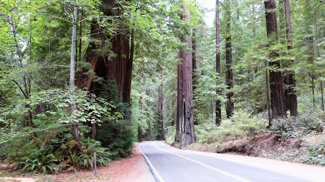

There were many places to pull off and take pictures or hike a ways into the forest. We drove the whole length of the avenue, then went back to camp, dropped off Poppy and investigated the little town of Myers Flat. There was a small grocery store and a coffee shop/bakery where we got some bagels for breakfast and Bob got the REAL milkshake he had been craving. We were debating staying another day here but when we got up on Sunday morning, we decided we should head down the road – there is so much to see in California and our time is limited.


There were many places to pull off and take pictures or hike a ways into the forest. We drove the whole length of the avenue, then went back to camp, dropped off Poppy and investigated the little town of Myers Flat. There was a small grocery store and a coffee shop/bakery where we got some bagels for breakfast and Bob got the REAL milkshake he had been craving. We were debating staying another day here but when we got up on Sunday morning, we decided we should head down the road – there is so much to see in California and our time is limited.
We wanted to spend a couple of days in Sonoma to see the
wine country but, since we got a late start on Sunday, we decide to just go
part way that day. We started out on
route 101 and went on to Route 1 which runs along the coast but we first drove
through more winding, mountainous roads before suddenly breaking out of the
woods and getting our first view of the Pacific Ocean from high atop a
cliff.

Well, actually it was MY first view as Bob had been to California before, not to mention he saw a lot of the Pacific Ocean when he was in Viet Nam. In any case, from that point on, Route 1 runs along the Pacific coast most of the time and the views are just breathtaking. I found myself constantly taking pictures. We stopped at a campground that was right on the beach between Fort Bragg and Mendocino. After Bob finished listening to the Panthers game on the radio (sigh), we took Poppy and walked down to the beach and let her play in the water.

It was definitely too cold for us to go in but beautiful to look at. Bob and I went into Ft. Bragg that evening and had dinner at a little seafood restaurant in Noyo Harbor, watching the fishing boats come in after a day of fishing.
The next day we headed down route 1 again for more thrills
as we wound around cliffs hundreds of feet above the water, often with no shoulders and the section of the road with guard rails like you see here are the exception to the rule -- but the views were spectacular.


(Sorry for the number of pictures from Highway 1 -- I couldn't pick -- it's all so beautiful!)
We headed inland a bit to a campground on the Russian River, very close to the Sonoma vineyards and were lucky enough to get another campsite right on the river. Our main purpose in being there, though was to see the wine country. On our first day, by the time we got settled in the campground, we only had time to visit the closest winery, which happened to be the Korbel winery. Their vineyards stretched for acres and acres and the tasting room was lovely. We tried several champagnes and a chardonnay and bought a few bottles as the prices were great.
On the second day, we canoed in the morning with Poppy. The Russian River, although down from its
usual level, was navigable by canoe and we were able to paddle upriver for quite
a ways as the current was very light. Then we paddled back down. We saw a lot of wildlife – ducks, great blue
herons, turtles and lots of other birds we couldn't identify.
This is the same limb in the water on our trip up the river and then on our trip back down!


After our canoe ride, we left Poppy in the camper and we went out to lunch in Duncans Mills – the pretty little town near the campground...

– and then headed out for the vineyards. As we drove through Sonoma, the roadsides were lined with vineyards and wineries.

There were hundreds of them but we have found that two tastings is all we can handle in a day so we went first to the Hop Kiln vineyard. I have tried and really liked Hop Kiln wines in the Cru Bar in Beaufort (at home) so we thought it would be fun to visit their winery. Their signature wines are their pinot noirs and we tasted several of them – all were delicious. The prices were much more than we usually pay for wine ($35) but we bought one bottle anyway. The building where they hold the tasting was very unusual and beautiful – it was old and was originally used for storing hops.


From there we went to the Merry Edwards winery – a
recommendation of our friends Betty and David Gray, who spend the month of
August in this area. Once again, pinot
noirs are their specialty and the young man who did our tasting was really
knowledgeable and able to answer all our questions about how they pick the
grapes and make the wine and why pinot noir grapes do so well in this
area. Their pinot noirs were delicious
but were $54 each – we bought a delicious sauvignon blanc that was a little
less expensive.


As I said, there were hundreds of wineries in the area –
many of the names we recognized – but once again, we needed to move on –
through San Francisco and south.